


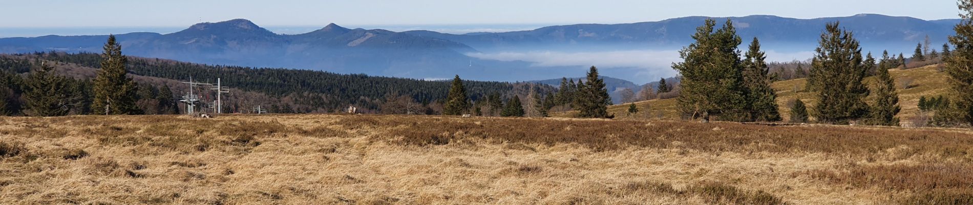
hohwald - champ du feu

mitch1915
User
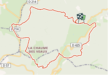

Length
12.8 km

Max alt
1103 m

Uphill gradient
500 m
Km-Effort
19.6 km

Min alt
634 m

Downhill gradient
550 m
Boucle
No
Creation date :
2020-01-22 11:10:56.37
Updated on :
2020-01-22 17:13:58.036
4h34
Difficulty : Medium

FREE GPS app for hiking
 SityTrail
IGN / Geographical institutes
SityTrail Plus
The world is yours!
About
Trail Walking of 12.8 km to be discovered at Grand Est, Bas-Rhin, Le Hohwald. This trail is proposed by mitch1915.
Photos


Positioning
Country:
France
Region :
Grand Est
Department/Province :
Bas-Rhin
Municipality :
Le Hohwald
Location:
Unknown
Start:(Dec)
Start:(UTM)
374385 ; 5362146 (32U) N.
Comments